
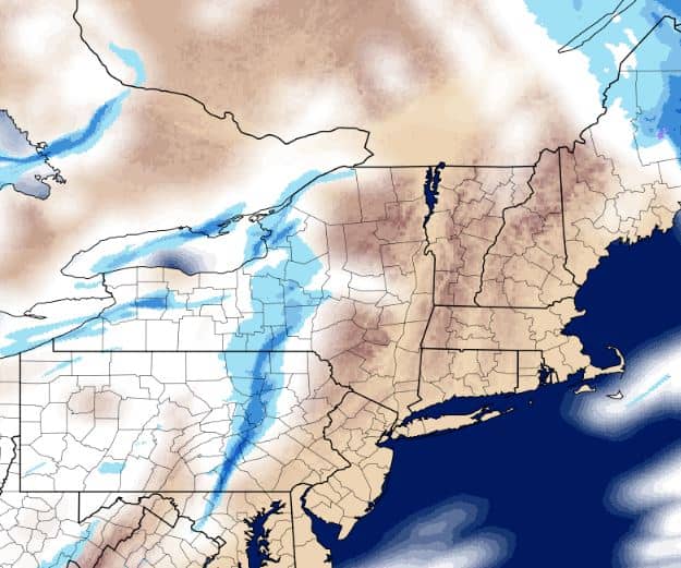
No, A Snow Squall isn’t a winter bird, it’s a quick moving snow system that can bring dangerous winter conditions, quickly.
The National Weather Service in State College, PA Has issued a Snow Squall Warning for our area. White-out conditions, blowing and drifting snow. The system will enter our area around 12:00 Noon, sooner for areas east and north of York, PA
SNOW SQUALL WARNING
NWS STATE COLLEGE PA
1004 AM EST WED JAN 30 2019

PAC001-027-035-037-041-043-055-057-061-067-081-087-093-097-099-107-109-113-117-119-133-301601-
/O.NEW.KCTP.SQ.W.0005.190130T1504Z-190130T1615Z/
1004 AM EST WED JAN 30 2019
Adams County-Centre County-Clinton County-Columbia County-Cumberland
County-Dauphin County-Franklin County-Fulton County-Huntingdon
County-Juniata County-Lycoming County-Mifflin County-Montour
County-Northumberland County-Perry County-Schuylkill County-Snyder
County-Sullivan County-Tioga County-Union County-York County-

The National Weather Service in State College PA has issued a

* Snow Squall Warning for...
Northumberland County in central Pennsylvania...
Southeastern Huntingdon County in central Pennsylvania...
Dauphin County in south central Pennsylvania...
Franklin County in south central Pennsylvania...
Southeastern Centre County in central Pennsylvania...
Snyder County in central Pennsylvania...
Columbia County in central Pennsylvania...
Union County in central Pennsylvania...
Perry County in south central Pennsylvania...
Cumberland County in south central Pennsylvania...
Southeastern Tioga County in north central Pennsylvania...
Southeastern Clinton County in north central Pennsylvania...
Schuylkill County in central Pennsylvania...
Adams County in south central Pennsylvania...
York County in south central Pennsylvania...
Mifflin County in central Pennsylvania...
Juniata County in central Pennsylvania...
Fulton County in south central Pennsylvania...
Lycoming County in north central Pennsylvania...
Montour County in central Pennsylvania...
Sullivan County in north central Pennsylvania...

* Until 1115 AM EST.

* At 1004 AM EST, a dangerous snow squall was located along a line
extending from Grover to near Snyder-Middleswart State Park to near
Doylesburg to 6 miles east of Hancock, moving east at 55 mph.

HAZARD...Whiteout conditions. Zero visibility in heavy snow and
blowing snow. Wind gusts greater than 30 mph.

SOURCE...Radar and webcams.

IMPACT...Dangerous life-threatening travel.

* For those driving on Interstate 80, this includes areas between the
Lamar and Nescopek exits, specifically from mile markers 174 to
247.

This includes the following Interstates...
Interstate 70 from mile markers 161 to 170.
The Pennsylvania Turnpike from mile markers 169 to 258.
Interstate 81 between mile markers 1 and 81...and from mile markers
98 to 139.
Interstate 83 from mile markers 9 to 50.
Interstate 180 from mile markers 1 to 29.
Interstate 283 from mile markers 0 to 2.

This snow squall will be near...
Troxelville, Beaver Springs, Snyder-Middleswart State Park,
Weikert, Shunk, McClure and Laurelton Center around 1010 AM EST.
Middleburg, Paxtonville, Colonel Denning State Park, Bloserville,
Fremont, Mount Pleasant Mills, Newville, Penns Creek, Lincoln
Falls and Richfield around 1020 AM EST.
Selinsgrove, Waynesboro, Carlisle, Greencastle, Kreamer,
Plainfield, Hummels Wharf, Kratzerville, Shamokin Dam and Port
Trevorton around 1030 AM EST.
Sunbury, Northumberland, New Kingstown, Carroll Valley,
Rouzerville, Wertzville, Hogestown, Carlisle Springs, Wayne
Heights and Schlusser around 1040 AM EST.

PRECAUTIONARY/PREPAREDNESS ACTIONS...

Serious injuries and deaths may result from people exiting their
vehicles during a snow squall. Drivers may not be able to see you or
to stop! If stopped on the roadway or involved in an accident,
quickly exit your vehicle move as far away from the roadway as
possible ONLY when it is safe to do so. Do not stand along or near
the roadway, since approaching vehicles may be unable to maintain
control.

LAT...LON 3973 7832 4031 7799 4079 7762 4163 7726
          4164 7688 4159 7684 4154 7623 4120 7632
          4114 7623 4095 7621 4091 7601 4083 7603
          4052 7624 4049 7642 4056 7654 4048 7668
          4020 7657 4012 7672 4005 7655 3972 7677
          3973 7832


